More tales from the Pennine Way
It’s now three years since I successfully completed the Pennine Way, and two years since I wrote about the first half my trek and how it ended in injury. After a week in the north of England I made it into Scotland, and in Edinburgh I planned a return.
And so it happened: After visiting the Scottish Highlands, the Lake District, and the Isle of Man, I was ready for another shot at completing the Way.
Waterfall country
Originally, I was meant to walk the 20 miles between Middleton-in-Teesdale and Dufton in a single day, but returning from injury meant that I split it over two days. That turned out to be the right decision anyway, since that section is filled with such amazing views that I couldn’t have done justice to it in a single day (such is the grandeur of the area that a south -> north trail goes south to make sure it includes the full beauty).
One of the area’s biggest draws is the waterfalls, including the imaginatively named “Low Force” and “High Force”, which attract lots of day-hikers. For example, I’m guessing that the people with canoes at Low Force weren’t walking the Pennine Way (I’m pretty sure my guidebook forgot to mention a canoe on its list of essentials).
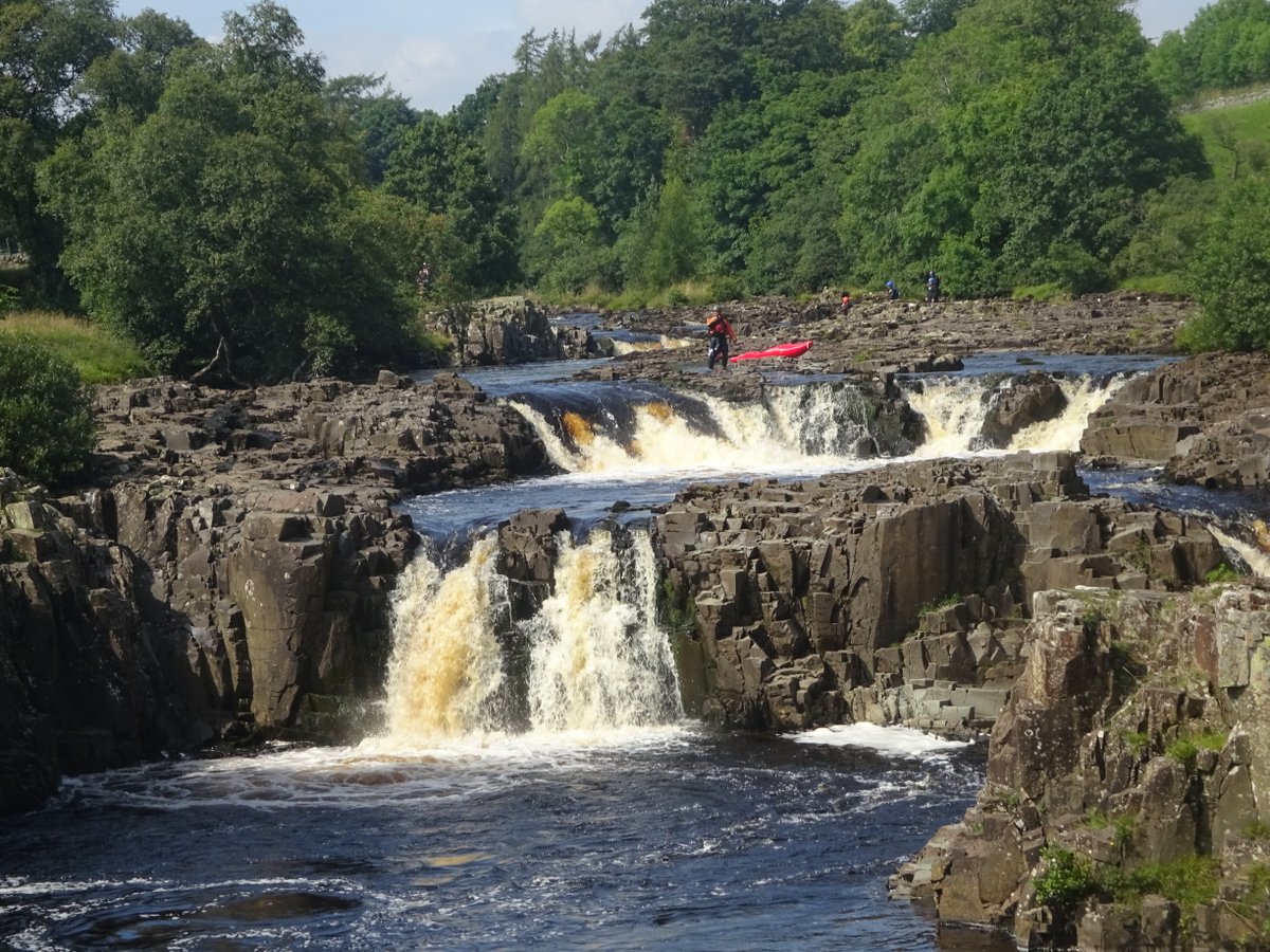
There were also people jumping off the high points into the water. This looked fun, but I imagine it would make it difficult to keep walking.
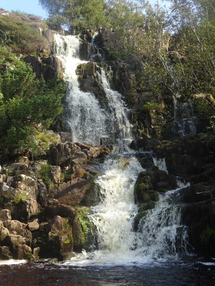
High Force itself can be difficult to get a good view of from the Pennine Way, but fortunately there were other waterfalls:
However, my favourite waterfall came the next day, the dramatic Cauldron Snout:
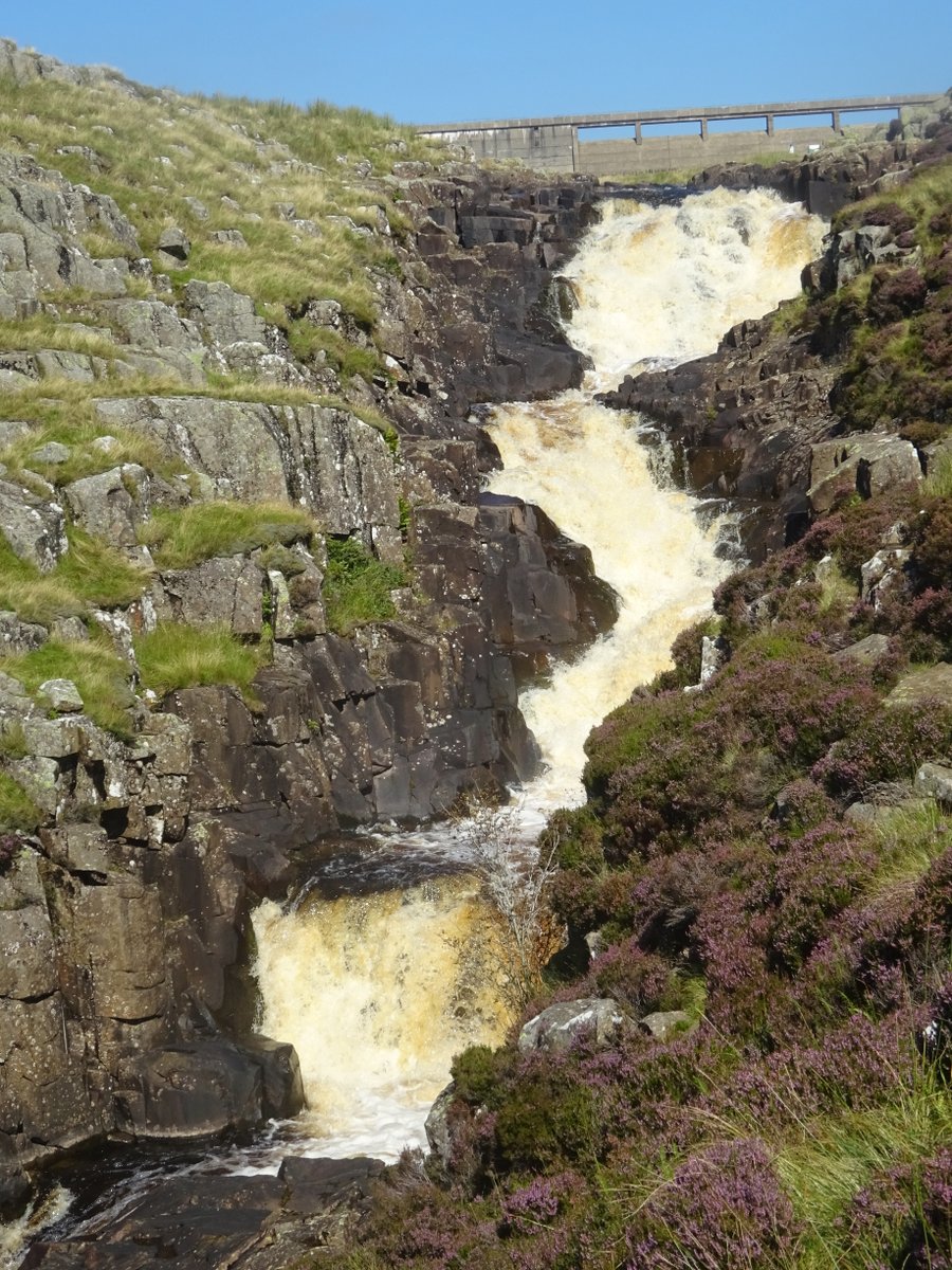
This seemed less well-known, and is probably further away from relevant roads. The trail past it is actually a rock scramble up the heather-covered slopes right next to the raging falls. Challenging with a full pack on, but also quite fun.
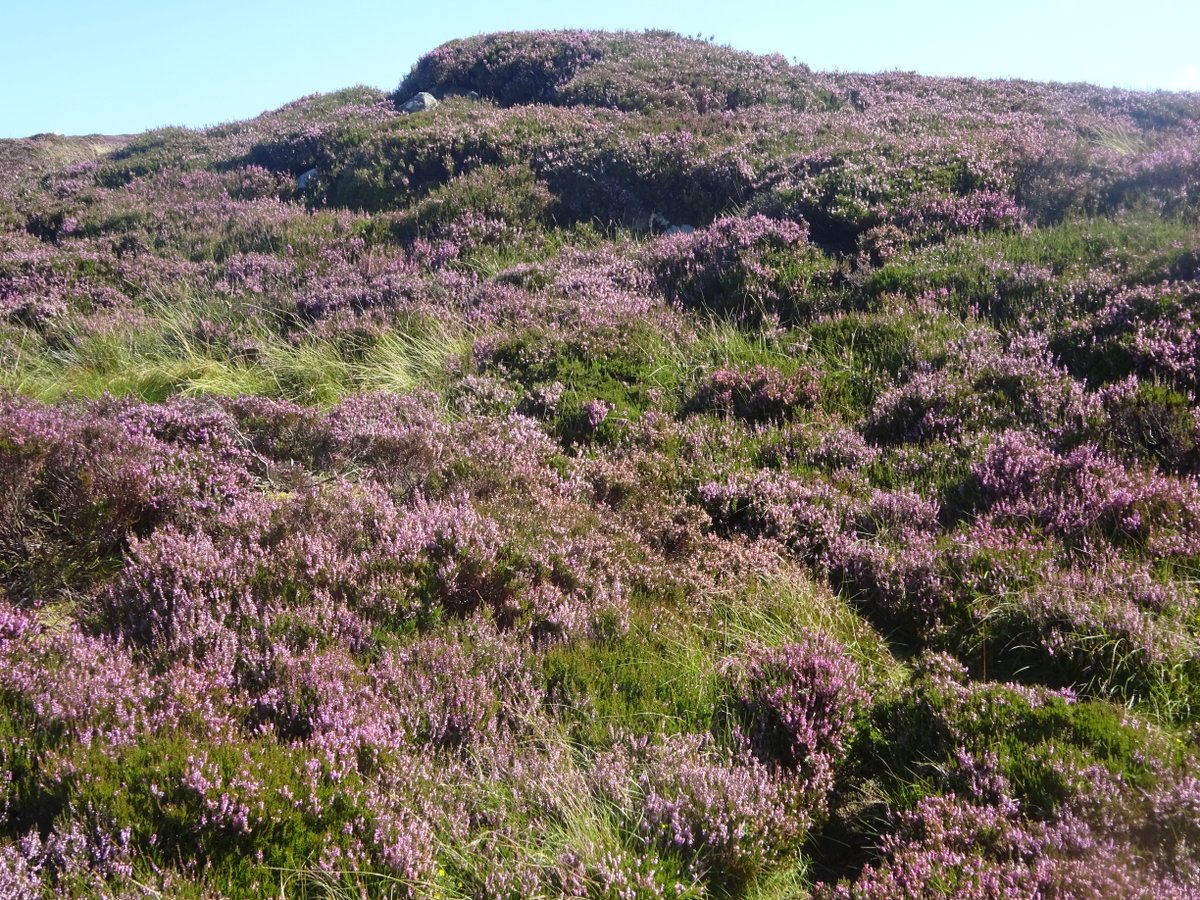
And that wasn’t the only place with heather in bloom: It was August, and the heather decorated the nearby hills and indeed much of the rest of the Way:
Daring rescue at High Cup Nick
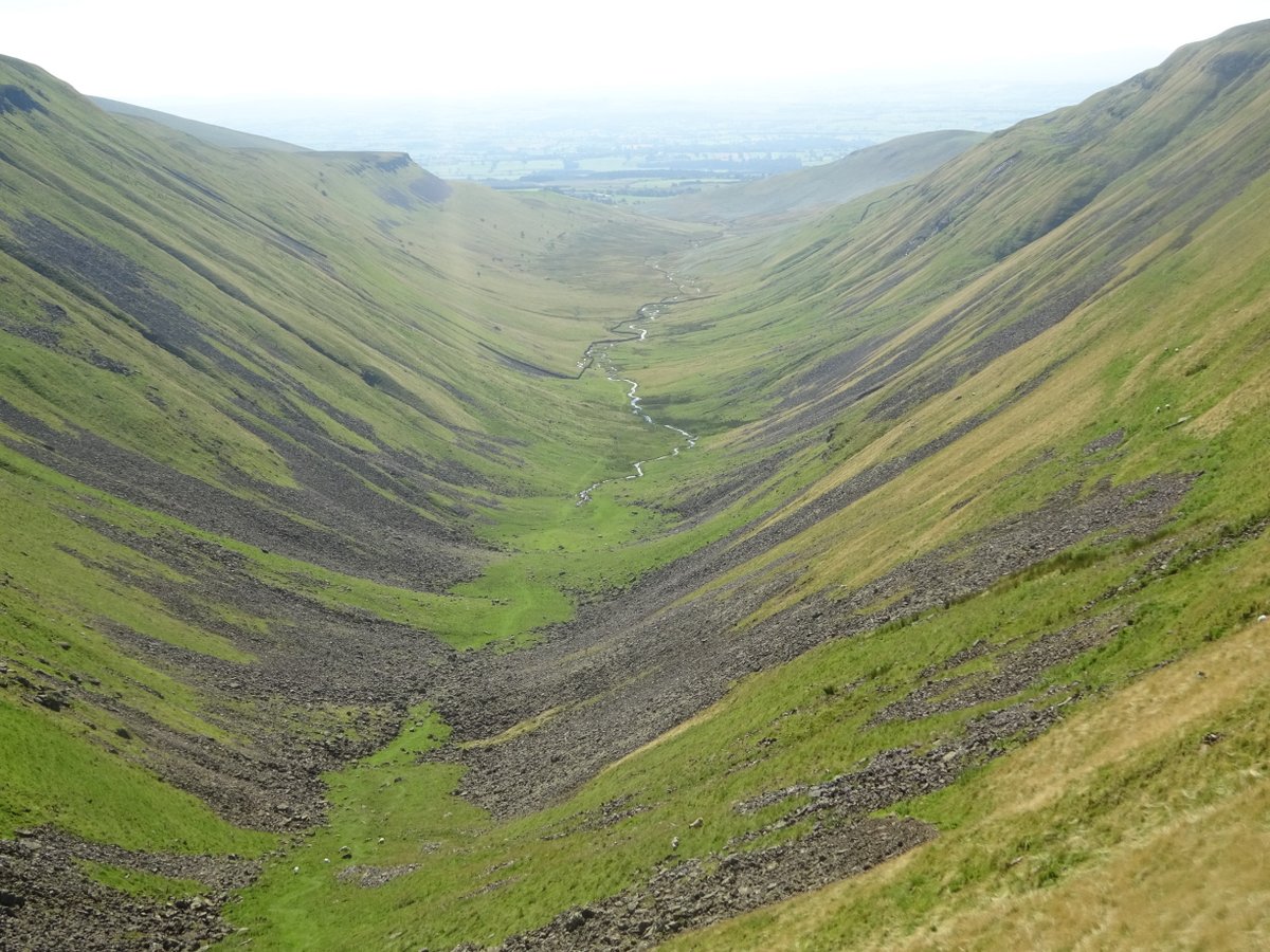
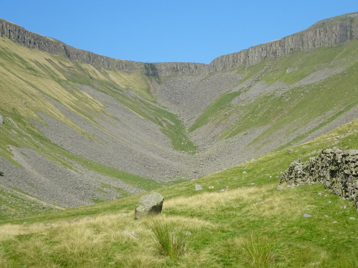
High Cup Nick is a deep glacial valley, widely considered one of the most impressive sights on the Pennine Way. I had been unimpressed by the pictures I saw of it, but the reality was stunning, certainly the best view I saw on the Pennine Way. What’s more, there appeared to be a rough trail down, and the valley itself looked inviting. Since I had spare time, I decided to climb down into the valley (though I really hoped I wasn’t going to re-injure myself crossing boulder-fields on a walk that wasn’t even part of the trail).
The view back shows how far I descended (and also how far I had to return):
From the start, I had known there was no way I could climb down with a heavy pack. So I left my pack up top, carefully placed on the rocks to prevent it from getting muddy. What could go wrong? In short, other people.
Apparently, while I was gone several groups of hikers met up the top and felt that the pack detracted from the view. Specifically, they were afraid that I had either fallen or jumped off the edge. And so they examined the pack (helpfully moving it into the mud in the process), then left a note for me explaining they had called Mountain Rescue.
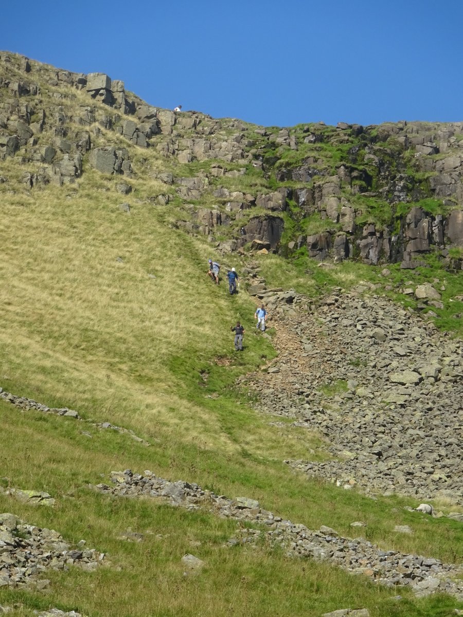
So there was I, admiring the beauty of the valley and not realising I was supposed to be in serious trouble. I even climbed back through the shifting boulder fields without so much as twisting an ankle. Then I met a group of hikers near the top, who informed me of the proceedings:
However, fortunately it all came to a satisfactory conclusion. Such was the valuable assistance of concerned citizens that I managed to restore myself to life and health without any more damage than a muddy pack.
Some fell-walking
In the Lake District, there’s a lot of talk about fell-walking. There’s even a detective story, The Fell Walker, which was on sale everywhere there.
One section of the Pennine Way does have a spot of genuine fell-walking, 20 miles in all with four fells to bag:
- Knock Fell (the smallest of the four, but because it was first had the biggest climb)
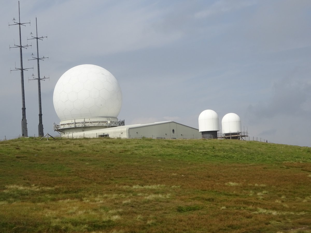
- Great Dun Fell (has a large weather station on it, though from a distance it looks more like a white soccer ball)
- Little Dun Fell (because why not?)
- Cross Fell (at 893 metres high the tallest peak in the Pennines)
Cross Fell in particular is notorious for difficult navigation in cloud or mist. Fortunately, I had beautiful weather the entire day, and brilliant views from each of the fells. However, my room-mate from the previous night wasn’t so lucky.
Just for the record, starting early has never been my thing. I’m more the person who needs an official checkout time to stimulate a last minute frenzy of packing (though I did make sure I left earlier for 20 mile days). My room-mate, on the other hand, decided to leave early to try and beat the projected afternoon rain. As it turned out, this meant that he arrived at Cross Fell just as cloud settled on it, completely missed the view, and needed careful compass work to get off again.
I, on the other hand, had everything go smoothly, and I don’t even think I ended up getting the forecast rain. Leaving late has caused me enough problems that it’s nice to occasionally be better off as a result.
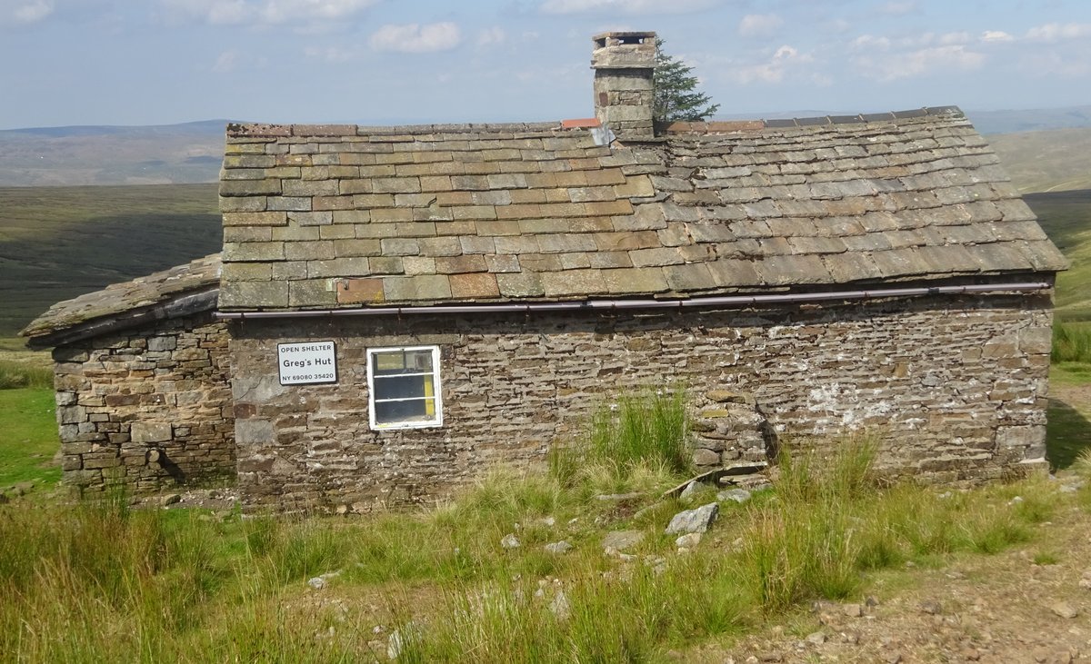
The route down from Cross Fell is the charmingly named Corpse Road. Apparently these roads were needed in isolated areas to provide a route to the nearest available consecrated ground - in this case 16 km away. It also passes Greg’s Hut, itself a memorial to John Gregory, killed in a climbing accident in the Alps:
With all these associations with death, I was glad to survive with nothing more than sore feet and happy memories.
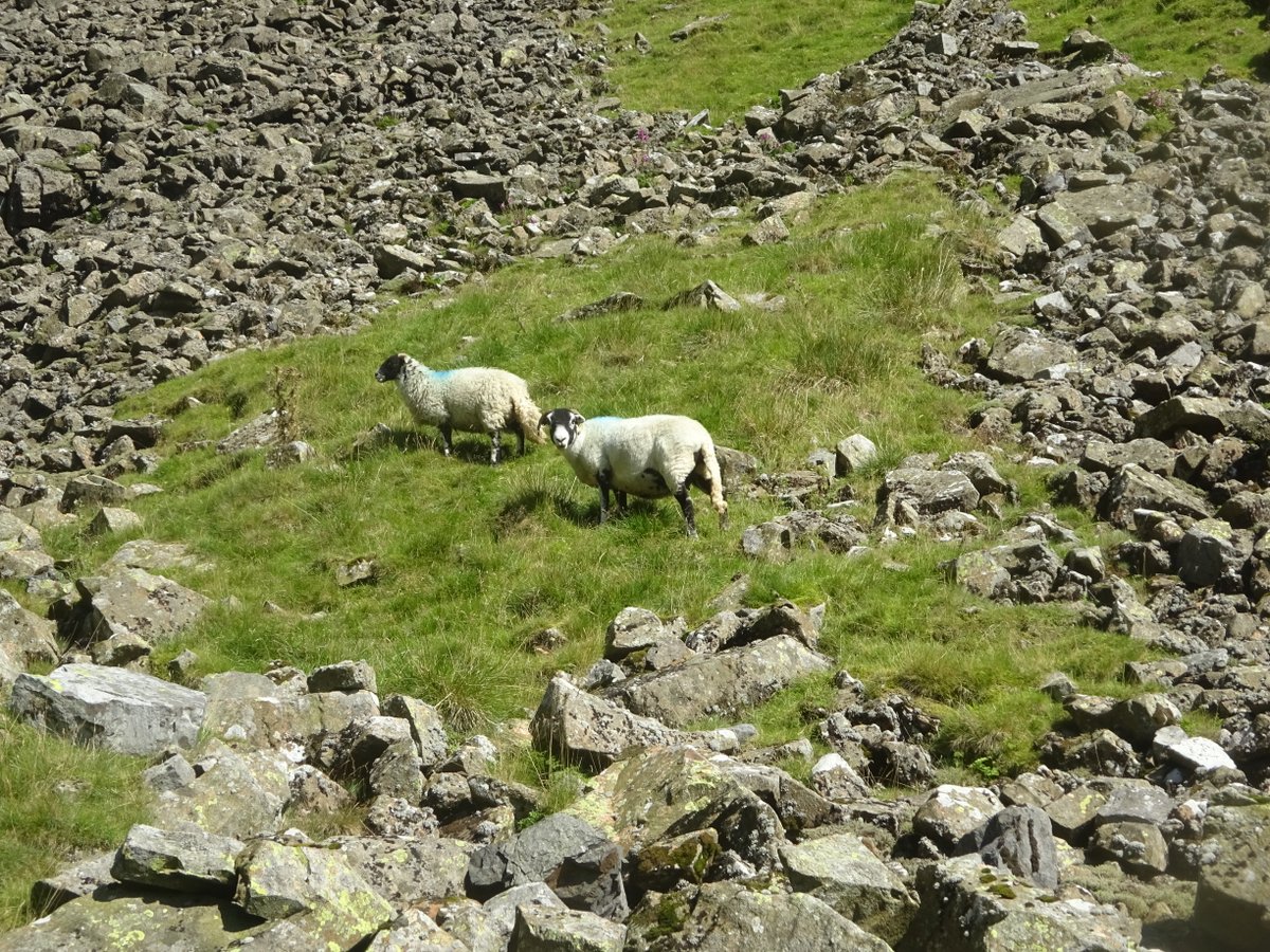
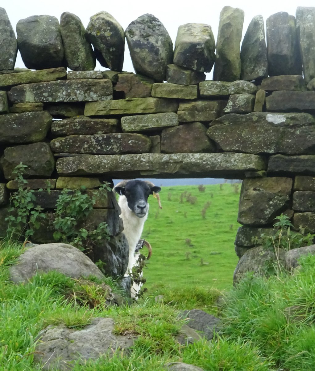
Some animal encounters
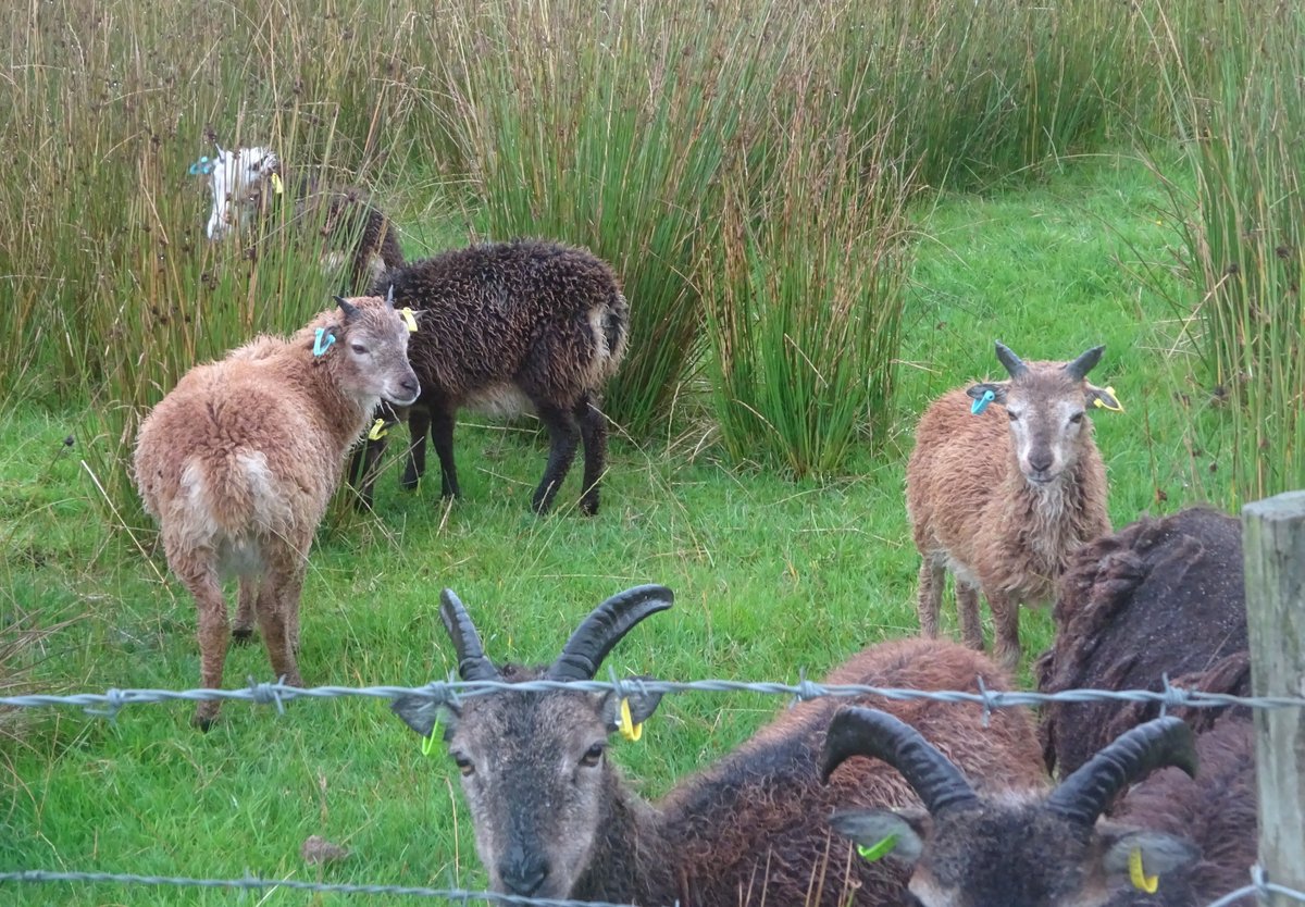
Since the Pennine Way often passes by (or through) farmland, it was quite common to see farm animals, and they often seemed interested to see me. For example, there were these goats in the middle of marshland near Hadrian’s Wall:
Or these cows further north, whose main job seemed to be inspecting passing strangers:
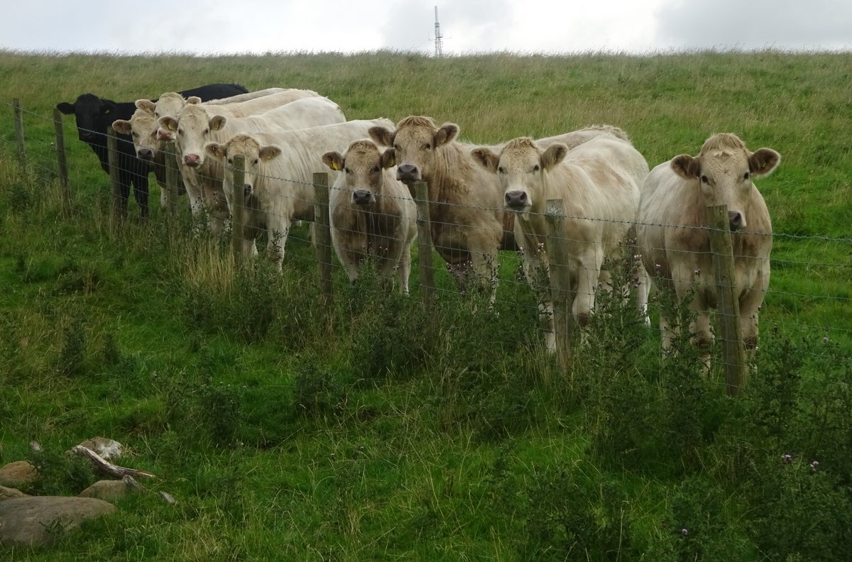
As I walked past they all shifted in perfect sync to keep watching me.
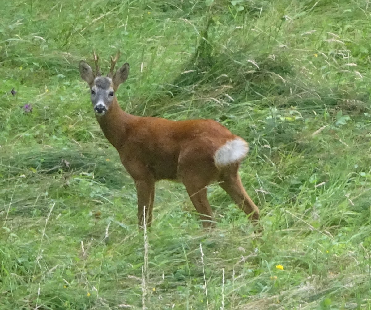
In the wild I also encountered a deer near the South Tyne Trail, though it was quick to spring away:
But perhaps the most memorable encounter was with a toad:
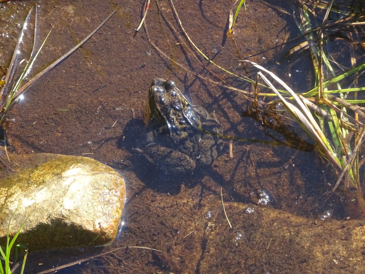
I was stepping across a puddle, intending to land on a flagstone right next to what seemed to be a pile of mud. As it turned out, this pile of mud was actually a toad, which showed itself to be alive in the most obvious way by jumping almost straight for me. This startled me so much that I nearly lost my balance and definitely lost my footing. And I defy my reader to react with greater composure when a pile of mud turns unexpectedly aggressive.
Connectivity in the wilderness
I knew that walking the Pennine Way would mean travelling through remote and desolate areas, so I wasn’t too concerned about being without the wonders of the internet. After all, I was on holiday - the occasional quick email to let family know how I was going was about as much as was expected of me. What’s more, the route was keeping me busy: During the day I was busy reaching the next milestone, and in the evening I was much more interested in making sure that I was fed, my clothes were dry, my phone and camera batteries were charged, and generally that I was ready to face another day.
However, since I was curious which parts of the Way had internet coverage, and since I did have a British SIM with almost unlimited data, occasionally I tested it. It turns out that the Web has extended its tendrils to some of the remotest and most unlikely parts of England. For example, I found coverage in Greg’s Hut, near the top of Corpse Road and miles from civilisation.
But perhaps the best instance was near the Langdon Beck hostel. The hostel itself does not have coverage. However, the middle of a nearby field does have coverage:
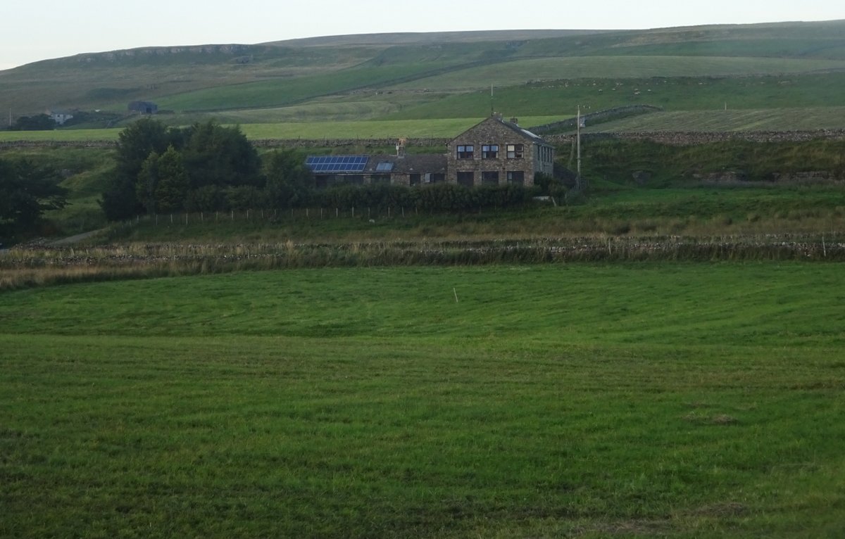
By the time I got out there it was long after dinner and the sun was setting. Imagine a nearly 360 degree view of grass and moorlands, with mountains covering a lot of the horizon and perhaps at most a dozen buildings in sight. It has to be one of the most spectacular settings I’ve ever checked my email in.
Truth to tell, I didn’t really have a need to check my email then and there, and I certainly didn’t respond to any of the emails I received. But hush! Our modern technology is about establishing what is possible, not what’s desirable or necessary!
Outposts of the Roman empire
The shadow of the mighty Roman empire lies over British history, and the Pennine Way reflects that. In the first half I had seen little more than an old Roman ford, but this half made up for it: There were Roman forts, Roman roads, and even sections of the world-famous Hadrian’s Wall. And the Wall itself had a bus route named “AD 122” in commemoration of the Wall’s commencement date, and a pub serving good food with the mighty legionary Maximus Nutrimens as its mascot.
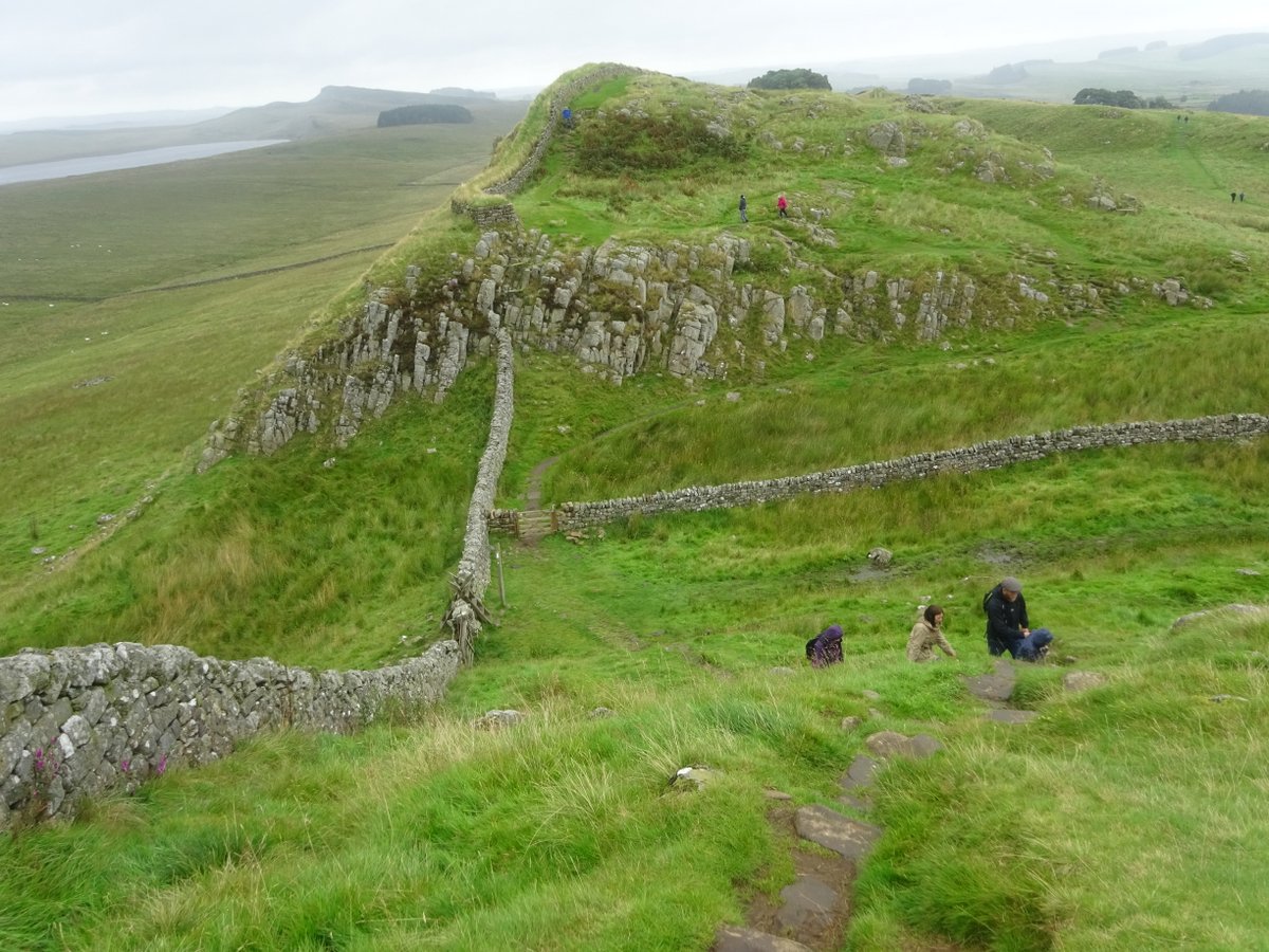
Hadrian’s Wall was one of the places I would probably have visited even if I hadn’t been on the Pennine Way. And the day I spent there was also the closest I got to a rest day: In the morning I visited the Roman Army Museum and the Housesteads Roman Fort, and in the afternoon only walked 9 miles in pouring rain. The route itself is brutal, going sharply up and down as the builders tried to seize the maximum advantage from any high ground available. But the resulting views are impressive.
I found it sobering considering the decay of this once-mighty empire. Once, this wall stretched from coast to coast and was considered the protector of civilisation. Many thousands lived, worked, fought, and died on it.
So what’s the result today? A wall that’s often well under shoulder height, and a fort claiming to be “the most complete example of a Roman fort in Britain” that’s rarely more than a few blocks high. Yes, the blocks remaining are still massive and well-laid, but they wouldn’t keep out a mouse, let alone an army.
And these are the well-preserved sections. Other forts have almost completely disappeared, as have large sections of the wall. And had it not been for preservation efforts in the 19th century, the entire wall might have been gone. The stones were recycled over the years, most significantly in building roads to try and respond to the 1745 Jacobite rebellion.
On the Pennine Way, one section of the wall is completely gone, swallowed up by a now abandoned quarry flooded to make a scenic lake. Other sections have been replaced with medieval dry-stone walls, clearly not designed to keep out the barbarians:
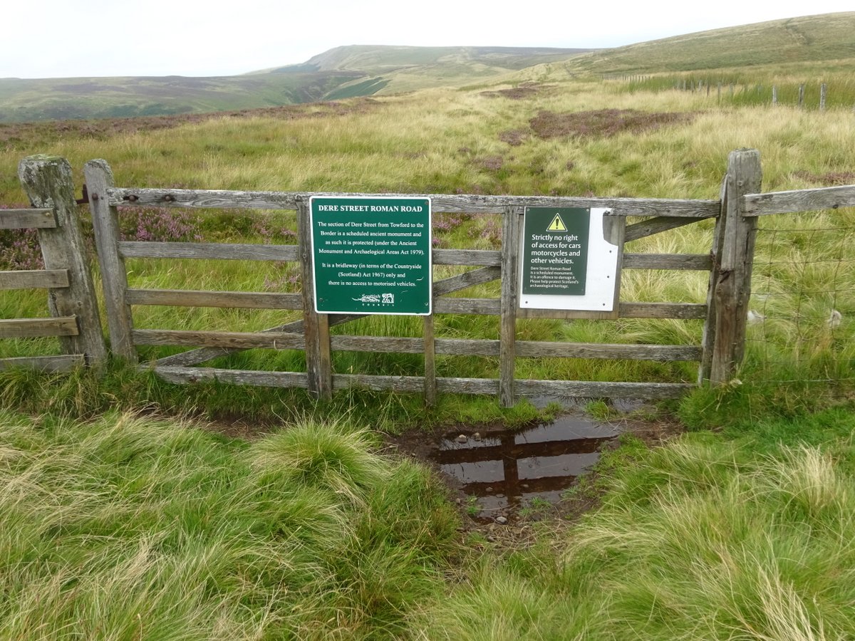
Further north, the Way passed Chew Green fort - still large, but now basically nothing more than a few humps in the ground (though it looks like a fort when seen from above). At least the nearby Roman road is in slightly better condition:
I fully expect that one day our civilisation will be like this: Crumbling ruins where there are now mighty cities and fortifications. Fragmentary stories to be pieced together from thin clues. That there will be a time when the Pennine Way is lost: not just its route (little more than fifty years old now) but even the idea of it. I don’t know how far away this time is, but come it must - unless we can unexpectedly buck history.
At the time, my deconversion was still recent and I was poorly equipped to wrestle with the problem of finding purpose in a world that doesn’t last. And so I’m pretty sure I questioned whether the effort building and defending the Roman civilisation had actually been worthwhile, and by extension whether my own efforts were worthwhile. A few years free of religion have given me a better perspective on this: My contributions to the world may not feel that important to our current civilisation, and may well be completely lost within in a hundred years. However, they are of value to me, and hopefully to those close to me. Walking the Pennine Way gave me time to reflect and ponder and appreciate being alive, and the benefits of that are still with me. This remains of value to me even though (I expect) neither I nor society will last forever.
And perhaps many of the Romans posted in these forts and marching along these roads thought their empire would last forever. That the expansion of Rome’s borders was inevitable, and that the Pax Romana would continue to extend and to offer barbarians a new and better life. That Rome itself was so strong and so successful that it could never fall.
If any did think this, clearly they were wrong: Hadrian’s rule was around the peak of the Roman Empire’s extent, in the early 400s Rome lost control of Britain, and in 410 Rome itself was sacked. However, I hope that the individual soldiers found meaning in their work, whether it was in upholding the empire, or in the camaraderie of service, or in the appeal of a fairly steady job, or in looking forward to a quiet retirement on their grant of land, or whatever it happened to be. It’s my conviction that that sense of purpose is not meaningless, even if it’s now gone forever.
A military encounter
Ancient Roman fortifications are one thing, but the Pennine Way also passes remote areas useful for army training. Near High Cup Nick I passed a military firing range on the moor, complete with “Keep out” signs. And after I left Byrness I found more such signs, with helpful messages like “Do not touch any military debris. It may explode and kill you”. However, I still wasn’t expecting to come across an actual training exercise:
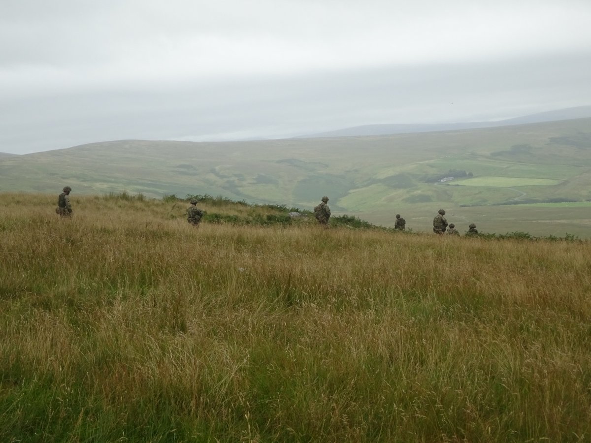
But suddenly there were troops in full camouflage gear crossing the trail in front of me and filing down the hill. At the time I could hear machine gun fire in the distance, and when I topped the next hill saw the machine-gunner directly below me. I really wanted to take further pictures, but decided it might be unwise. Later, I heard lots of helicopters and some distant explosions, which was completely unexpected in an otherwise fairly lonely region.
Given that final stretch through the Cheviots is 26 miles without any available accommodation, I’d opted to stay 2 nights in Byrness and be picked up and dropped off near the halfway point. And in the process, I discovered that the entire area has a lot of military activity: The route down from the Way had a sign on the gate “Out of bounds to military vehicles”, and part of the road back to the B&B was a military road (built by German POWs in 1945 and 1946). Apparently there is even a replica Afghan village somewhere in the area.
In a somewhat more sombre note, that evening we were told to let our relations know we were safe, because it was in all the news that one of the soldiers had been killed during training exercises.
Mud, mud, glorious mud
One of the joys of the Pennine Way is encountering mud in great quantities, particularly north of Hadrian’s Wall. In the southern half of the Way my boots had already shown they weren’t as waterproof as they were meant to be (even walking through dewy grass could get both boots and socks soaked). This only got worse in the last week. I’d heard stories of people going in up to their waist, so going knee deep once wasn’t so bad. However, even though it was only rarely more than boot deep, I still found it more difficult than I expected.
Part of the problem is that I like spending time picking my next step when walking through difficult terrain, and it was difficult to do that while my boots were slowly sinking. However, when I tried to hurry it, all it took was one mistake and I was in deeper than ever. And at times it felt like everything was so wet that it couldn’t get any wetter, but it still did.
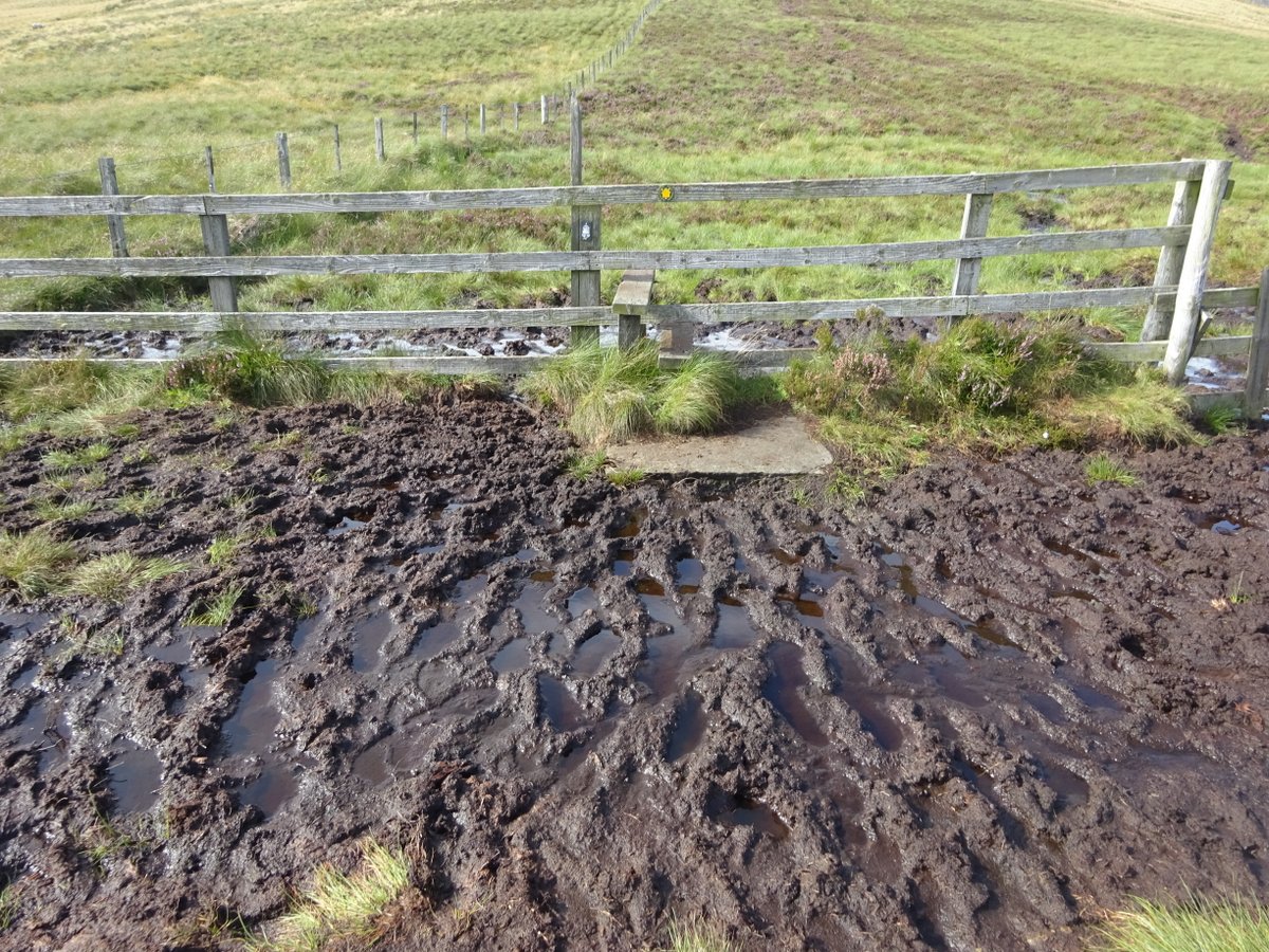
For me, the worst section was a stretch of a mile or more where there was absolutely no avoiding being ankle deep the entire way, with mud that seemed ever more clinging. It surprised me how exhausting this was: By the end, I felt I couldn’t take another step, and literally sat down and did nothing for half an hour (well, nothing other than ineffectual attempts to dry my boots and socks). And then there was the traveller at the end of that day who said he hadn’t found it that muddy. When we expressed incredulity, he finally mentioned that he’d taken a detour because his guidebook said it was too muddy…
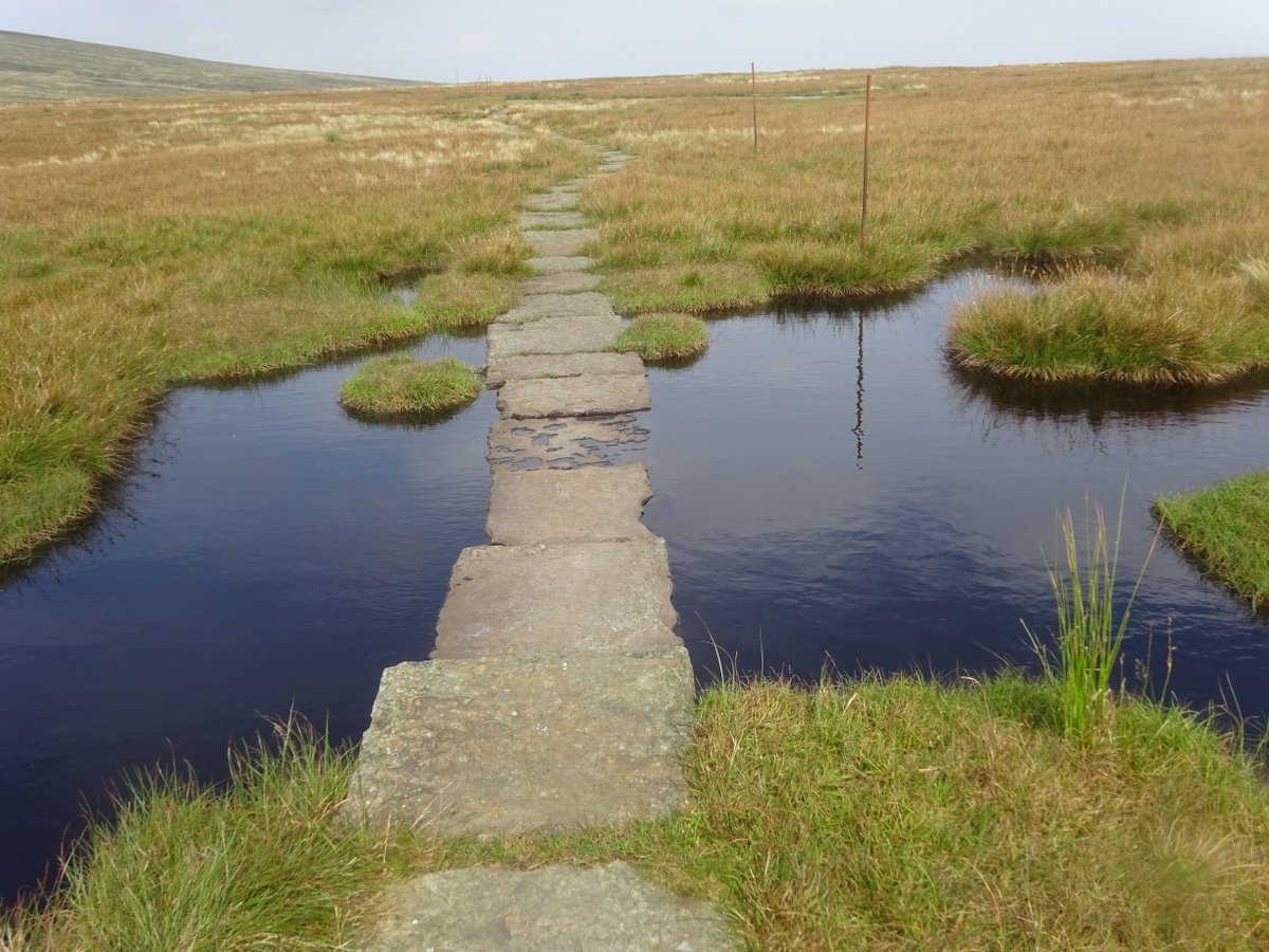
Fortunately, some of the areas have flagstones, though of course the flagstones themselves could be submerged.
You mean it’s over already?
A few days before the end I’d dealt with rain, mud, and more mud, and was thinking “I’ll be glad when this is over”. Then the last couple of days were sunny, and splitting the 26 mile stage into two allowed me to relax and enjoy the scenery. I could even do a pack-free detour to visit the highest point in the Cheviots (no, this time Mountain Rescue was not called).
Suddenly, I found myself almost wishing I could keep going. It had been quite a journey: nine days since I’d restarted, nineteen days in all, and probably 500 km in all after side-trips were included. I’d grown attached to the life-style, and now it was just about over. When I reached the asphalt road, I knew it meant the end of steep and muddy trails. But at least I had time to appreciate one last tiny village before returning to the big city:
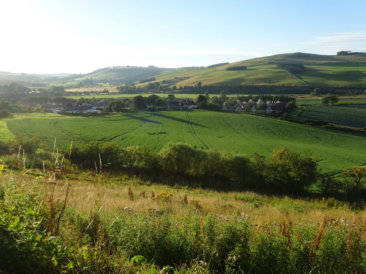
For the first time on the Way, I was looking towards a Scottish village. I’d walked along the border fence for miles, but had finally crossed it for the last time. I walked on to the Border Hotel and did all the expected things there: I had my photo taken, wrote my name in the Pennine Way book, and got a certificate.
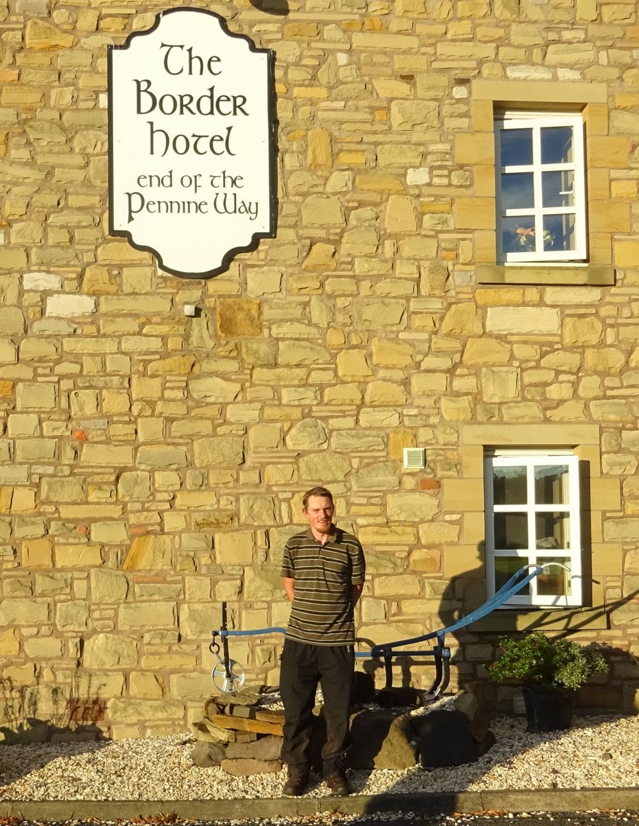
I had a final pub meal, and discussed with a friendly cyclist the relative advantages of cycling and walking for seeing the country. The Way was complete, so I did the sensible thing and relaxed planned desperately for my next adventure.
The memory effect, Part 2
In the first half, I spoke about the memory effect, and it applies here as well. I realised going back to my diaries that I’d built a comfortable mythology around this half: Things had gone a lot better second time round. I was prepared, I was ready, and completing it was almost a formality (as much as 15 mile days are ever a formality). The Pennine Wayfarer cloak that I’d reluctantly discarded weeks before slipped on immediately and fit better than ever.
And that is all to some extent true. But my diaries also show that I felt I was facing new and different pains every day: For example, one day I talk casually about feeling like my back is broken, while another day it was not being able to take a step without pain. Though I still walked 15 miles with a full pack on both those days…
I was nervous, too: Even before I’d started the Way, I knew that walk-ending injuries were a theoretical possibility. However, now I really understood for the first time that they could actually happen to me. While I’d done everything I could to give me the best shot at finishing, I was still afraid it wouldn’t be enough. Yes, I’d been lucky that my UK trip was long enough to give me a second chance, but there was no time for a third try: If I failed, that was it.
So, like on many walks I’ve enjoyed over the years, there were times on the Pennine Way that were painful and dispiriting, and I don’t want to ignore them. But nor do I want to over-emphasise them, because once I got through them it was the positive memories that remained. In fact, it’s a little shocking hearing how bad I was feeling at times, because I just don’t remember any of that.
Three years on, I still sometimes look back to and talk about the Pennine Way, and I imagine completing it will be a memory I value for life. And so for me that temporary pain was well and truly worth it.
Culture shock, Part 2
At the end of the first half, I noted how disorienting it was entering Bishop Auckland, a town with a population of 25,000. This time round I didn’t feel it nearly as much, even though my bus took me to the much larger and grander Edinburgh. Perhaps I was better prepared for it, and perhaps I was just too busy planning my next steps. But it’s worth remembering that I’d only left Edinburgh a few weeks before. On my approach, I saw Salisbury Crags and Arthur’s Seat, both of which I’d climbed. And the city itself, while crowded, was equally familiar.
However, there was a greater change in store, because the following morning I was due to fly to Geneva. In the Cheviots I’d been fully rugged up and still cold, while in Geneva it was 30°C and the following day found me sitting by Lake Geneva in shorts. What’s more, I was eating haggis-flavoured chips and reflecting that it was only 48 hours before that I’d been struggling through mud approaching the end of the Pennine Way. I may not be the first person to do this particular combination, but it can’t exactly be normal.
Fortunately, there was a Roman tie-in to make me feel at home: I came across a mural of Julius Caesar arriving in Geneva in 58 BC, shortly before all Gaul was conquered* and the Republic was set on the path to Empire, and a mere 165 years before Hadrian came to power. And Geneva itself turned out to be a gateway to the Alps, mountains far taller and grander than the Pennines, with snow and glaciers and mirror lakes and all things pretty.
* Why yes, I do read Asterix. Why do you ask?
Would you walk the Pennine Way again?
In short, probably not, unless I were to walk it with someone else who hasn’t. From my perspective, England is on the other side of the world, and I don’t even know if I’ll ever return there. If I were there long enough to plan for a long-distance walk, I’d be more likely to choose the Coast-to-Coast walk, or to return to the Scottish Highlands and complete the West Highlands Way. However, I would definitely recommend the Pennine Way to anyone who loves hiking.
There are certainly some beautiful sections of the Pennine Way that I’d consider returning to, but more likely as day hikes (after all, it was a day hike around Malham in 2013 that first made me aware of the Pennine Way, long before I was foolish enough to consider thru-hiking it).
In principle, I would like to do a thru-hike in my home state of Victoria, maybe the Great Ocean Walk or the upcoming Grampians Peak Trail. In practice, it clearly hasn’t been high enough on my priority list to actually happen in the last three years, and I don’t know whether that will change or not.
Conclusion
I think my story shows that the Pennine Way is achievable for a moderately fit hiker. I lacked good overnight hiking experience and wasn’t sure whether I was ready - but it turned out in spite of adversity I could complete it.
So, did the walk change me significantly, or make me a better person? No, not really. I don’t think I got any deep epiphanies - just a sense of quiet satisfaction in achievement. Walking it was a rewarding experience, and so was completing it.
However, whether or not I do another long-distance hike, I think the Way changed my perspective on hiking. It made me more receptive to longer hikes, to carrying larger and heavier backpacks if necessary, and to doing more things on foot. And that has greatly improved my life.
Perhaps this was best shown in the Swiss Alps a week after completing the Way. I was in Grindelwald, and planned to travel to Lauterbrunnen - a comparatively short distance as the crow flies, but requiring a much lengthier train journey. Suddenly I realised that I could just put my pack on my back and walk (the trail between the two is actually a segment on one of Switzerland’s overnight trails). And I loved it: The views on the way were amazing, particularly those of the Eiger, Mönch and Jungfrau peaks. Unlike on a train, I was free at any point to spend as long as I liked appreciating them.
That is the true power of a lengthy thru-hike: Time to appreciate the country you walk through.