Tales from the Pennine Way
This time last year I was in the middle of walking the Pennine Way. I’ve already written an overview of the experience, but in this post I want to give a feel of some of the many experiences on a long and varied trail.
This post covers the first half of the walk, from Edale to Middleton-in-Teesdale, where I left the trail for an unscheduled injury break. The second installment can wait until mid-August when I resumed the trail.
Photos
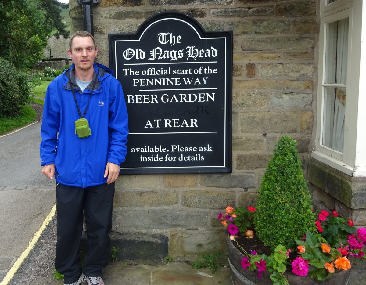
I have put a collection of photos for this half of the walk on Flickr. Fortunately, none of them include me in them. But here’s a picture just after I arrived in Edale.
General
For the first few days, I wasn’t really sure whether I was ready for the walk or not. I certainly didn’t have much experience with overnight walking, and walking 20 miles on my first day was probably a mistake, though it was difficult to avoid. After a few days, though, I settled into a routine, and seemed to be completing each day OK. I could even find most of what I needed near the top of my pack, or even better in one of my pockets.
This section was July, in the middle of the English summer. The days were long, so I was never in danger of running out of light. More of a pressing concern was making sure I arrived early enough that grocery stores (if any) hadn’t closed and pubs hadn’t given up on serving food. The dawns were extremely early, but mostly I couldn’t manage to get out the door before the 10AM checkout time, preferably after a Full English Breakfast.
The Kinder Trespass
The first section of the Way is in the Kinder Scout area, where the famous Kinder Trespass occurred in April 1932. This has been credited with establishing the right to roam for the masses over the grouse-shooting rights of rich landholders. However, those rights were really only granted after WW2, with the Peak District being the first national park declared in 1951.
This section also contains the Kinder Downfall. Even without much water flowing it’s an impressive rock fall, but apparently when the wind direction is right the water can be blown uphill rather than falling as normal. Locals told me there is a pool near the bottom of the falls called the Mermaid’s Pool. Reputedly if you see the mermaid in the pool on Easter Eve she will grant you immortality. However, since another version of the tale has a man drowning himself in the pool because he fell in love with her, I’d suggest putting that quest for immortality off for a few years.
Grouse 1, Grouse 2
Several sections of the Way went through grouse moors, including Bleaklow on the first day. When disturbed, a grouse would suddenly appear from the reeds or long grass with a whirring noise and fly off. What I found interesting was how well they were concealed. It was always a surprise when they appeared, often from a place I had already walked past. After one appeared, I would look round carefully, but there really wasn’t a lot of cover, so I would conclude that there couldn’t possibly be any more about. But no sooner did I conclude that than another grouse would suddenly appear from an area I just checked!
The best view ever?
Some parts of the Way were particularly beautiful, and other parts were comparatively mundane. I quickly found that my fellow hikers wanted to consider what they were looking at particularly nice. Being accommodating, I would listen to their opinion without feeling a need to agree with it.
It first struck me on my second day when I met a couple going the other direction who said the current view was “One of the nicest views we’ve had the entire way.” Though I didn’t say it, I felt disappointed, since I hadn’t found it particularly impressive. Fortunately, once they had continued on I looked about again and realised that there was a lovely view back into the valley. At least I got a nice picture of it. I guess I’d just found it a hard struggle to climb out of that valley and wasn’t in the right mood to see its beauty.
The joys of route-finding
There are claimed to be 458 direction signs on the Pennine Way (more than one per mile), and there are certainly many to be seen. But there are still plenty of opportunities to be misled by a misunderstanding of the GPS or the guidebook maps. Sometimes there is no clear trail. Other times, there are multiple clear trails with nothing to distinguish between them, or one very clear trail that also happens to be wrong. And after not seeing any directions or markers for a while it’s hard to avoid the suspicion that you’ve gone astray somehow - even if you still appear to be following the route. That makes it doubly welcome finding the simple acorn marker showing that you went right after all.
Large sections of the Way were originally constructed by joining together existing lanes and rights of way, and the join points can be indistinct or confusing. Even when sticking to the route it can seem like an obstacle course, with gates to open and close, stiles to climb over, and muddy sections to try and avoid. After a few weeks on the Way it felt like I’d seen every possible type of gate and gate fastening around (though I did find new types in Switzerland). Some gates opened easily and closed automatically. Others had complicated ways of opening, or were difficult to close again afterwards. The worst was a series of high stiles with gates at the top that wouldn’t fit a hiking backpack through, requiring me to take my bag off then lift it bodily over the high wall before climbing over myself.
Hay-mowing time
A lot of the route goes through farmland. Usually this is good, because there is one clear trail showing which one of the five gates around the field is the correct one. However, after a few days it turned out that it was hay-mowing time. Once a field had been mown, not only was there no clear route across, but it was usually better to walk around the edge of the field rather than trying to climb over the thick heaps of mown grass.
I can only imagine how much more difficult it would be to find the route in snow if no-one has used it recently. But people do walk the Pennine Way in winter. There’s even the Spine Race, where competitors vie to complete the route in winter conditions in less than a week (it takes most summer hikers 2 - 3 weeks).
Brontë Country
One of the busier sections of the Way was Brontë Country. Here, the trail passes Top Withins, a ruined farmhouse on a hill that has long been associated with Wuthering Heights, in spite of the Brontë Society plaque saying that it has no resemblance to the house Emily Brontë described. At the time, I hadn’t read Wuthering Heights, but since several people told me it was a great book I read it afterwards. Personally, I didn’t think it was that good, and would not recommend it.
Brontë countryside, on the other hand, is interesting. That night I was staying in Haworth, a place where the Brontë family had grown up and which has a museum dedicated to them. Unfortunately, while it was a lovely town, I hadn’t realised it was at least 3 miles off the trail.
Since I wasn’t camping, the need to find lodging caused trouble for most of the first week. Each night I had had to go a couple of miles off trail, and that just added pressure to the start of the next day. Fortunately, the rest of the Way I was able to stay at places within a few hundred metres of the trail, so more of my walking time counted towards completing the Way.
Isn’t the Pennine Way long enough for you?
After a few days I was overtaken by a cheery fellow who was six weeks into a walk from Land’s End to John o’ Groats, and was clearly enjoying every minute of it. Talking about it with a fellow Pennine Way walker that evening, we agreed that he was almost indecently bouncy given how much further he had walked than we had. I don’t think I’ll be trying his route any time soon.
Volunteer YHAs
A couple of the hostels I stayed at were small enough that they were volunteer run. People volunteer to run the hostel for a week, and are then able to spend free time exploring the area (particularly in the break between check-out and check-in). The volunteer hosts I met were really friendly, though they might not always have followed the process correctly.
The one that stood out particularly was Earby. I think there were four of us Pennine Wayfarers staying overnight, a couple of whom I’d met on earlier days. The host for that week was a school-teacher who had finished the school year and was taking a week of volunteering as a break. And, as I filled in the appropriate form, I noticed she was reading The Black Swan, a book that I had sitting on my desk back at work.
There was nothing officially organised for breakfast, so I had got some ham the previous evening. When I finally got down in the morning, it turned out that it had become a “share what you have” breakfast. We all fit round a single table, and the meal itself was simple (ham, cheese, bread, and fruit), but the friendly atmosphere made it a lovely occasion.
Return to Malham
In 2013 I visited England for work and spent a week on leave. One of the places I visited was Malham, a beautiful spot in the Yorkshire Dales. It was on the Pennine Way, giving me my first indication that the Pennine Way even existed. Back then I had never done an overnight walk and thought those walking the Pennine Way must be crazy (though maybe I still think that). I was looking forward to getting back there, and when I arrived it was every bit as beautiful as I remembered.
Near Malham is Gordale Scar, about a mile off the Pennine Way. In 2013 I thought it was the single most impressive landscape feature I saw in England, so of course in 2016 I wanted to visit it again. In fact, I pushed myself to make sure I would have time to do a circuit walk before dark, also saving the need to visit it with a full pack. And it was even more impressive than I remembered, probably the best feature on this half of the Pennine Way (though it’s off the trail and doesn’t really count).
This also exposed an interesting difference in hiking philosophy: I talked about it with a fellow hiker, and his opinion was that any mile walked which didn’t contribute to completing the Pennine Way was a wasted mile. While I understand that sentiment, to me it’s worth visiting interesting places not on the direct route if they’re not too far out of the way and won’t interfere with completing the main mission.
Along the trail to Gordale Scar is a small waterfall called “Janet’s Foss”, and I was surprised to see a bridge over the top of the falls that I didn’t remember. Though there were some tourists on it, it didn’t really look permanent. However, all was soon to be revealed: Later that evening, just when I thought I’d got the dorm room all to myself, in came a late arrival. After a bit of discussion I found that he was doing work experience with a film director, and had just come from a 13 hour filming session in the heat. He was staying here because the next few days were being shot at a nearby waterfall. So I guess that bridge was to be used in the filming process. Mystery solved.
The Green Dragon
Few Pennine Way walkers stop at this place in Hardraw, since there is a larger town a mile before it. However, once I saw it on the map I decided this was the right place to stay. Not only does the name sound interesting, but it is also the name of an inn near Hobbiton. While this particular Yorkshire inn probably wasn’t in Tolkien’s mind, it is a nice place with history stretching back to the 13th century. Plus it just happens to have the tallest single-drop waterfall in England in its grounds.
Weather forecasts
Where I had internet access, I looked up various forecasts online. None of them were very accurate. However, sometimes I did find an accurate forecast source: the man at breakfast. There were multiple times when I talked with someone in the morning and they said “The forecast said …”. I really don’t know where they got this forecast from, and sometimes it was completely different to the online forecasts, but it was always more accurate.
I didn’t mind getting wet, but…
Hiking the Pennine Way gives access to many beautiful views, but also holds out the prospect of plenty of rain. One day the guidebook told me I would pass the impressive Blackstone Edge, as well as a number of boring reservoirs. However, it rained most of the day, and all we could see was rocks looming out of the white on either side and a hint that there might be reservoirs in the near distance.
Later, a fellow walker said to me “I didn’t mind so much getting wet. But it was supposed to be an impressive section, and we couldn’t see a thing.” Next day, the cold and wet could mostly be forgotten as we donned dry clothes and boots and faced a new section of trail. But the likelihood for both of us is that we will never walk that trail again, and so will never see those views.
It’s not a big deal, but to me it does highlight the effect of memory on experiences. Often hardships fade, while joys and achievements remain. I suspect it is generally better dealing with temporary hardships rather than passing up opportunities to create lasting memories.
Unsolicited advice
Along the way I received plenty of unsolicited advice, both from fellow walkers and from random strangers. Some of it was helpful, but a lot of it was completely unnecessary.
In particular, I noticed that if anyone saw me looking at my guidebook they would assume that I was completely lost and needed help. In reality, my main source of directions was a rough GPS route on the maps in my phone, so I always knew where I was. I only looked back at the book to see what was coming next or to try and figure out a fine navigation detail (this could be quite difficult, since I hadn’t been following the map closely enough to place myself on the map…) No matter how much the random stranger thought I needed help, it was unlikely that they knew enough about the Pennine Way to answer the specific navigation question I wanted answered. Worst was the time when a random stranger insisted I had to retrace the route I had come to get to my destination for the night. Maybe that was the best way to reach it by road, but I had a trail to follow and maps that showed clearly that they were wrong. I was too polite to say what I really thought of this interference, but just went on and left them shaking their head at the crazy foreigner’s stubborn rejection of local advice (for the record: I arrived at my destination with no trouble).
On my first day I met a bunch of local hikers, who freely admitted their hike was much shorter than mine, but still had no doubt that they should be telling me in a condescending but friendly way that everything I was doing wrong. In particular, that without walking poles in this kind of terrain I was guaranteed to twist my ankle and have to limp home again. For the record, the guidebook had suggested not using walking poles unless you were used to using them. I have only ever tried them hiking into the Grand Canyon on an icy day, and hated them enough that I’ve never used them since. And not only did I not twist my ankle, but I don’t remember feeling particularly at risk of it.
By contrast, the most helpful unsolicited advice on the entire trail was given very apologetically by a fellow Pennine Way walker. He overtook me in the mist and rain, then came back to show me I had adjusted my backpack completely wrong. He was very nice about it, saying “I’m sorry if I’m interfering and you like it that way, but I think it would be more comfortable this other way.” But really, back then I was no expert in using a heavy pack, and was only too glad to accept expert advice. And this advice made a massive difference - really made the entire walk easier.
The half-way point!
Near Baldersdale is the official half-way mark. At that point, my guidebook said “Surely only injury can stop you now”. Ironically, though, I had injured my right leg a couple of days earlier, and the injury was getting worse every evening. In fact, only a few miles after that half-way point it got so I could hardly climb over a stile because I couldn’t put my foot on the other side without pain. Any kind of jump over puddles needed to land on the left foot rather than the right foot. But, even though I was clearly struggling and had a 20 mile section the following day, it was still difficult to convince myself I needed to quit. Eventually, wisdom reluctantly prevailed, but even then I couldn’t get to sleep till 5AM, by which time it was almost sunrise and light was already pouring into the room.
NHS to the rescue
My final day was a Friday, so Saturday found me looking for a doctor to consult. As a service, the NHS phone-line had flaws, some of which amused the software developer in me. But I was impressed by how much they did.
Within five hours of ringing them on a weekend I had travelled to a nearby town, got an appointment, been seen by a doctor, had an X-ray, and been given useful treatment advice. And, what’s more, it cost me absolutely nothing. I believe I was covered by a reciprocal healthcare agreement with Australia, but I didn’t have to provide any documentation. I know many complain about the NHS, and maybe I would find more problems if I stayed in the UK longer, but I like the principle of providing healthcare based on who needs it rather than whether they can afford it.
Culture shock
I had read about how much of a culture shock it can be returning to normal life after a long distance walk, but it still caught me by surprise. The town I first entered was Bishop Auckland, with a population of around 25,000. Hardly a big place, given it was a month since I’d left London, and less than two weeks since I’d been staying in Birmingham city centre.
But still, as the bus carried me in I was amazed at what I saw out the window: Heavy traffic. McDonalds. Fuel stations. Multiple grocery stores. Even big shopping centres. Seriously, on the Way you knew you’d got lucky if the village had a Co-op (preferably open after 6PM) or more food options than just the standard village pub.
Fortunately, I got over the culture shock quickly and spent some unplanned time exploring the north east of England. I was forbidden from doing too much walking or from carrying a heavy pack, and my feet were also judged in need of some TLC, but the doctor made sure I knew I didn’t have to do absolutely nothing. Of course, had she known me better she would have realised that the difficulty would have been convincing me to do absolutely nothing. But it was nice to have permission to largely ignore my injury so long as I was a careful tourist rather than a Pennine Wayfarer. I enjoyed the chance to spend time exploring Durham, Alnwick, Berwick-upon-Tweed, and the Holy Island of Lindisfarne on my way to Scotland.
Conclusion
Hopefully that random account appeals to armchair travellers. In fairness, I have mostly highlighted things that were special and unusual. There was a lot of day-to-day walking involving little but drudgery, and I’m sure there were times when I didn’t want to go on. But overall, it was a rewarding experience.
If anyone wants to know even more or feels inspired to try it for themselves, feel free to contact me or to comment below.
Be sure to come back for Part 2 in August next year (?) sometime (ed: Part 2 is here. Turns out it was August after all. Just that it was two years later than planned).